File:Map of CoMS.png
From CoMakingSpace Wiki

Size of this preview: 724 × 599 pixels. Other resolution: 2,000 × 1,656 pixels.
Original file (2,000 × 1,656 pixels, file size: 326 KB, MIME type: image/png)
Summary
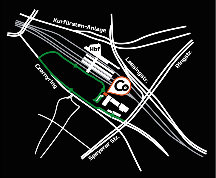
Map of the CoMakingSpace relative to the main train station.
Licensing
This file is licensed under CC-BY-SA 4.0. You are allowed to use and alter this file freely as long as you share it under the same license and attribute the original author(s).
File history
Click on a date/time to view the file as it appeared at that time.
| Date/Time | Thumbnail | Dimensions | User | Comment | |
|---|---|---|---|---|---|
| current | 07:03, 10 January 2018 |  | 2,000 × 1,656 (326 KB) | Pakue (talk | contribs) | Map of the CoMakingSpace relative to the main train station. |
You cannot overwrite this file.
File usage
The following file is a duplicate of this file (more details):
There are no pages that use this file.